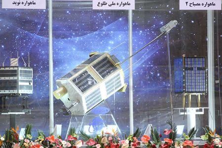
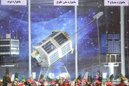
Iran to launch two satellites to take high resolution wall maps and aerial photos of locations as seen from space
 Head of Aerospace Industries of Iran's Electronics Industries Co., Asghar Ebrahimi, said the Islamic Republic will soon launch two satellites to take high resolution wall maps and aerial photos of locations around the globe as seen from space.
Ebrahimi told ISNA news agency on Monday that Iran will send the Fajr (Dawn) satellite into space by September, while the Tolou (Sunrise) satellite will be launched in February 2012.
Ebrahimi noted that the national Fajr satellite has been developed and produced by Iranian aerospace experts in less than a year. It weighs 50 kilograms and is technically characterized by an orbit which could promote from 250 to 400 kilometers through a thruster or an engine.
The Iranian aerospace official added the Tolou satellite weighs less than 80 kilograms and will be placed in elliptical orbit of 400 kilometers in radius.
Tolou will have a lifespan of one and a half years and will capture images with a resolution of 50 meters and then transmit them to stations on earth.
